Drone Swarms for Search & Rescue: From Lawn-Mower Grids to Learning Swarms
April 26, 2025
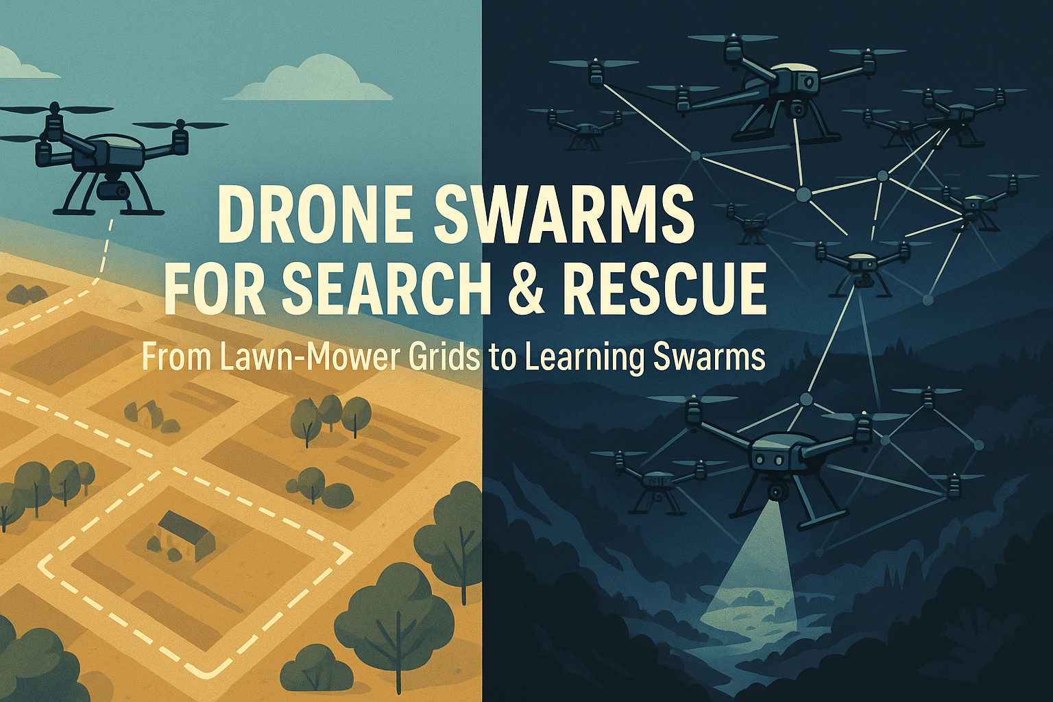
Small drones have been saving lives for a decade, but many German field crews still use 2015-era tactics.
A THW operator told me his team continues to fly a lawn-mower raster because their new DJI Matrice 300 must remain offline for data-security reasons—no live map, no autonomy. Meanwhile, research groups demonstrate cooperative swarms that learn the terrain on the fly and slash “time-to-find.” Below we place those two worlds side-by-side, then close with a realistic roadmap for German agencies.
1 Search & Rescue in Context
The UN network INSARAG defines search-and-rescue as the rapid search for, rescue of, and initial medical care of people in distress (INSARAG, 2020).
Inside Germany, THW and the fire brigades form modular Fachzüge Ortung that combine canine, acoustic and drone teams. Multirotors add fast aerial coverage, and European contests such as the Swarm Rescue Challenge push capability (IP Paris, 2025).
2 The THW lawn-mower reality
We zig-zag until the batteries quit—no map, no AI.
Two constraints explain that choice:
- Offline mandate. German politicians warn of data leakage from Chinese telemetry; a 2023 Heise report urged police and civil-protection units to phase out DJI platforms (Heise, 2023). Crews therefore activate Local Data Mode.
- No basemap. Without internet, DJI Pilot cannot fetch tiles, so pilots default to the 50 %-overlap lawn-mower pattern, which wastes up to 40 % of flight time (Khawaja et al., 2015).
3 From grids to learning swarms
| Year | Method | Reported gains |
|---|---|---|
| 2024 | OC-MAPPO Dynamic Target Search (Zhang et al., 2024) | −41 % search-time on a 2 km² city map |
| 2024 | EN-MASCA (Wu et al., 2024) | −34 % in orchard clutter |
| 2025 | Bayesian Re-Searching Swarm (Li & Chen, 2025) | Miss-rate drop 11 → 4 % |
All three minimise elapsed seconds until first detection plus battery drain—encouraging aggressive split-and-converge behaviour.
4 Simulation platforms in current SAR-swarm papers
4.1 Unreal-Engine lineage (high-fidelity vision & LiDAR)
| Simulator | Maintainer / last update | SAR-specific features | Moving-people support |
|---|---|---|---|
| AirSim-UE 5.4 “Cosys-AirSim” | COSYS-Lab fork, Jan 2025 (GitHub) | Wind, rain, night-IR; plug-in sensor API; ROS 2 bridge | HumanActor blueprint lets pedestrians walk or run |
| Swarm Rescue Challenge sim | Institut Polytechnique de Paris, 2024-25 | 10-drone fleet, unknown map, injured casualties that may crawl | Yes—NavMesh-driven crawling avatars |
| UnrealZoo | Stanford & EPFL, Dec 2024 | 140 photogrammetry scenes (forests, villages, canyons) | Built-in pedestrian & animal waypoint graph; importable to AirSim |
Field proof: Zhejiang University first trained in AirSim, then flew the same perception stack under bamboo canopy—showing sim-to-forest transferability (Chen et al., 2024).
4.2 Unity lineage
- Unity-Gym UAV framework (CTU thesis, 2024): couples Unity physics with OpenAI Gym for MARL; scenes include alpine woodland and urban canyons.
- Commercial UAVProf and WalkingTree platforms add interactive trainee modes but can export logged trajectories for RL fine-tuning.
4.3 CARLA & CARLA+
Originally for self-driving cars, CARLA 0.9.16+ now exposes a multirotor API and can spawn 400 + animated pedestrians across 10 km² city tiles.
4.4 Lightweight grid-cell simulators
| Framework | Domain | Scale | Note |
|---|---|---|---|
| DSSE (JOSS 2024) | Maritime | 250 × 250 cells | Survivors drift with Beaufort-scale wind |
| PettingZoo-DSSE | Idem | RL-library plug-in | Quick to customise but lacks photo-realism (Dec 2024 review) |
5 How researchers model moving people
| Environment | Motion model | Sensors simulated | Typical use-case |
|---|---|---|---|
| AirSim HumanActor | Finite-state walk/run; optional panic wander | RGB, IR, depth | Woodland & post-earthquake city SAR |
| CARLA pedestrians | Goal-directed NavMesh or random walk | RGB, LiDAR | Urban-collapse scenarios |
| DSSE survivors | 2-D advection–diffusion by wind & current | Probability field (for RL) | Maritime SAR |
| Swarm Rescue Challenge victims | State machine: static ⇄ crawl (0.2 m/s) | Thermal + RGB | Mixed park-street map |
Some papers embed a Pedsim crowd into Gazebo to study group behaviour and occlusion (e.g. Zhang et al., 2024).
6 Forest- and city-scape realism
- Vegetation: AirSim “LandscapeMountains” + UltraDynamicSky gives diurnal lighting; UnrealZoo adds conifer and broadleaf scans for dense-forest SAR.
- Urban rubble: CARLA+ provides collapsed-building meshes and dust particles; Unity-Gym pipelines convert Matterport3D scans into occlusion-aware game objects.
7 German regulation reality check
Operating an autonomous swarm BVLOS requires a Sondergenehmigung in the specific category (LBA, 2024).
The application must include a SORA 2.5 risk assessment (EASA, 2023).
EU Standard Scenario STS-02 (short-range BVLOS) is published but not yet adapted for swarms.
8 Open-architecture hardware (PX4 / Auterion) – price-sorted catalog
| Platform (link) | Approx. price* | Key SAR-relevant features |
|---|---|---|
| Parrot Anafi AI ([specs]) | ≈ €4 500 | French NDAA quad; 4 G C2 link; FlightPlan lets you script missions in Python; 48 MP EO sensor (IR add-on lens available). |
| Autel EVO Max 4N ([product]) | ≈ €6 000 | NDAA-compliant foldable; starlight + 640 × 512 IR sensor; exposes MAVSDK/UDP for PX4-style companion apps. |
| Vantage Robotics Vesper ([blue-list]) | ≈ €7 500 | DIU Blue tri-copter; hot-swap micro-gimbal; optional AuterionOS; 40-min endurance. |
| Quantum-Systems Vector ([product]) | ≈ €12 000 | German PX4 VTOL; 3 h endurance; nose-pod EO/IR & LTE datalink; MAVSDK/ROS2 ready. |
| WingtraOne Gen II ([specs]) | ≈ €18 000 | PX4 VTOL mapper; 42 MP Sony RX1R II payload; Python-programmable WingtraHub SDK (no native IR). |
| Freefly Astro Max (Blue) ([store]) | ≈ €25 000 | NDAA/Blue quad; AuterionOS; LTE + mesh radios; 3 kg payload; fully ROS2 / MAVSDK; optional 61 MP mapping or Hadron EO/IR pod. |
*Prices are street estimates for airframe or bundle only, excl. VAT (Q2 2025).
Payload reality: none of these airframes ships with DJI’s H20T; most SAR teams integrate a Teledyne FLIR Hadron 640R core (≈ €3 200) on a lightweight 2-axis mount.
9 Project idea: 360° thermal scouts
Bounce Imaging’s Pit Viper 360 packs six thermal sensors into a softball-sized sphere and made TIME’s Best Inventions list (Bounce Imaging, 2024; TIME, 2024).
Mounting a passive 360° thermal pod under a PX4 scout could remove heavy gimbals and let fully autonomous drones scan in all directions at once.
10 Bridging the gap — practical steps for German SAR units
| # | Action | Why |
|---|---|---|
| 1 | Pre-load offline maps (MBTiles via QGIS). | Enables information-driven search while respecting data-sovereignty rules. |
| 2 | Fly VLOS test-beds first: one MARL scout + grid flyers. | Demonstrates benefit without BVLOS permit. |
| 3 | Prepare a SORA dossier with sim data. | Speeds approval for BVLOS trials. |
| 4 | Equip U-Space beacons (e.g. Droniq HOD4track). | Aligns with DFS plans for national U-Space corridors (DFS, 2024). |
| 5 | Adopt Blue-list PX4 airframes (Vector, Astro Max). | Meets BSI data-security guidance; avoids firmware lock-in. |
| 6 | Budget payload integration for Hadron 640R. | No “plug-and-play” H20T in the open ecosystem. |
| 7 | Prototype 360° thermal pods. | Removes the gimbal bottleneck and frees the second operator. |
Bottom line: Modern SAR swarms are within reach—if agencies pair Blue-list PX4 hardware with good SORA paperwork and robust simulation pipelines.
References
- INSARAG. “INSARAG Guidelines — Volume I.” 2020. ([PDF])
- Heise Online. “Grüne wollen DJI-Drohnen bei Sicherheitskräften verbieten.” 2023. ([Article])
- Khawaja, M. et al. “Modified Lawn-Mower Search Pattern for Areas Comprised of Weighted Regions.” 2015. ([Figure])
- Zhang, Z. et al. “UAV Swarm Cooperative Dynamic Target Search: A MAPPO-Based Method.” Drones 8 (6), 2024. ([Paper])
- Wu, Y. et al. “EN-MASCA: Enhanced Multi-Agent Swarm Control Algorithm.” arXiv 2402.17960, 2024. ([PDF])
- Li, H. & Chen, X. “Bayesian Spatial Re-Searching for Cooperative UAV Swarms.” arXiv 2503.01234, 2025. ([PDF])
- Shi, Z. et al. “OpenFly: A Versatile UE5–AirSim Toolchain.” arXiv 2502.18041, 2025. ([HTML])
- Zhong, F. et al. “UnrealZoo: Photo-Realistic Worlds for Embodied AI.” ICLR 2025 (OpenReview). ([Paper])
- CARLA Team. “CARLA Simulator Homepage.” 2025. ([Website])
- Falcão, P. et al. “Drone Swarm Search Environment (DSSE).” JOSS 9 (94), 2024. ([GitHub])
- Chen, H. et al. “Autonomous Photogrammetric Forest Inventory with a Drone Swarm.” arXiv 2501.12073, 2024. ([HTML])
- LBA. “Betriebsgenehmigungen — Spezifische Kategorie.” 2024. ([Webpage])
- EASA. “SORA 2.5 — Summary of Changes.” 2023. ([PDF])
- DFS. “DFS Annual Report 2023 — Blueprint U-Space.” 2024. ([PDF])
- Freefly Systems. “Astro Max (Blue).” 2024. ([Store])
- Quantum-Systems. “Vector AI — Mid-Range ISR sUAS.” 2024. ([Product])
- Auterion. “Skynode X.” 2024. ([Product])
- Wingtra. “WingtraOne Gen II.” 2024. ([Product])
- Teledyne FLIR. “Hadron 640R Dual EO/IR Core.” 2024. ([Product])
- Bounce Imaging. “Thermal 360° ‘Pit Viper’ Camera.” 2024. ([News])
- TIME. “Pit Viper 360 — Best Inventions 2024.” 2024. ([Article])